
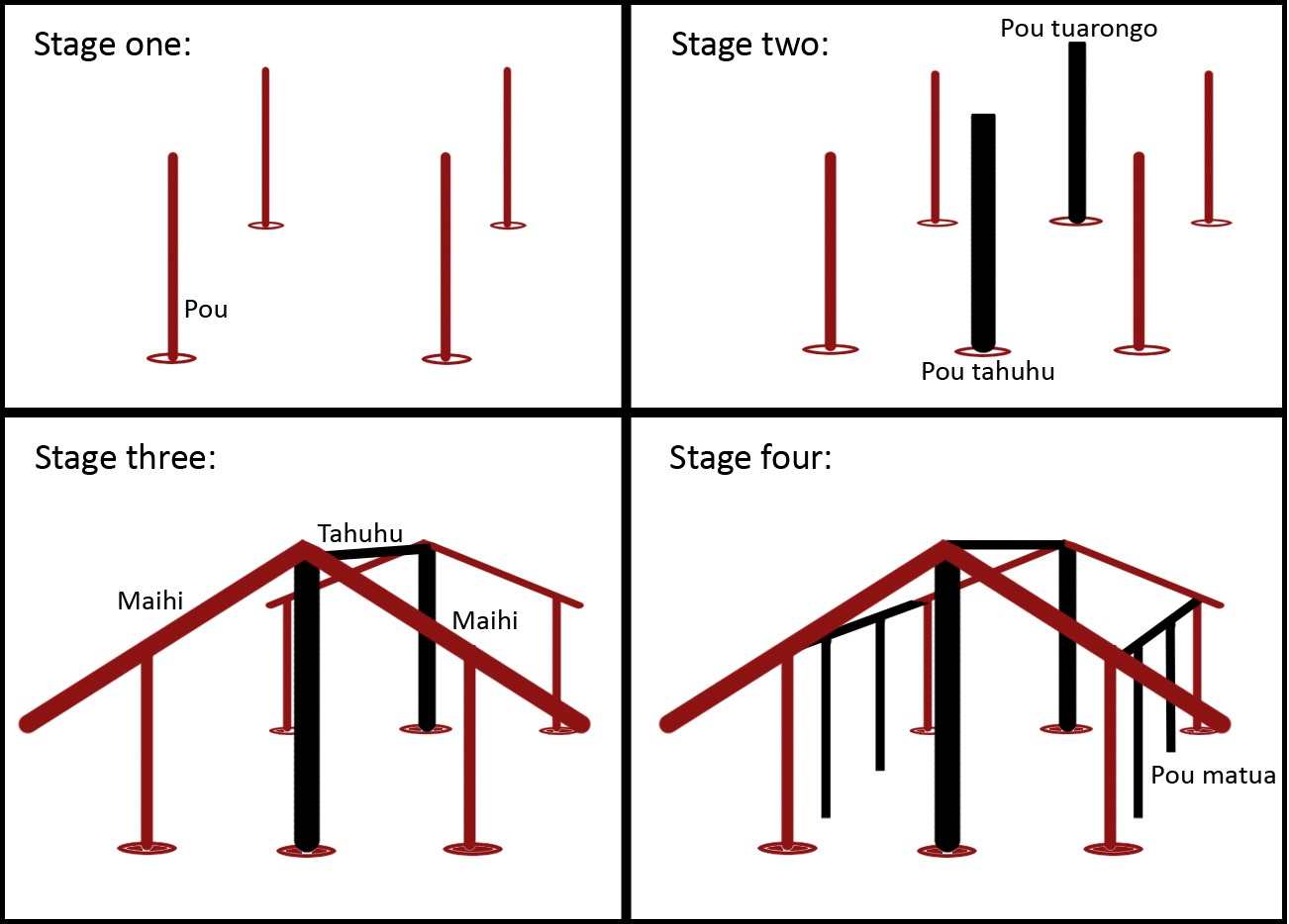
We talk about land borders and how Maori viewed each other, houses, marae and their construction!
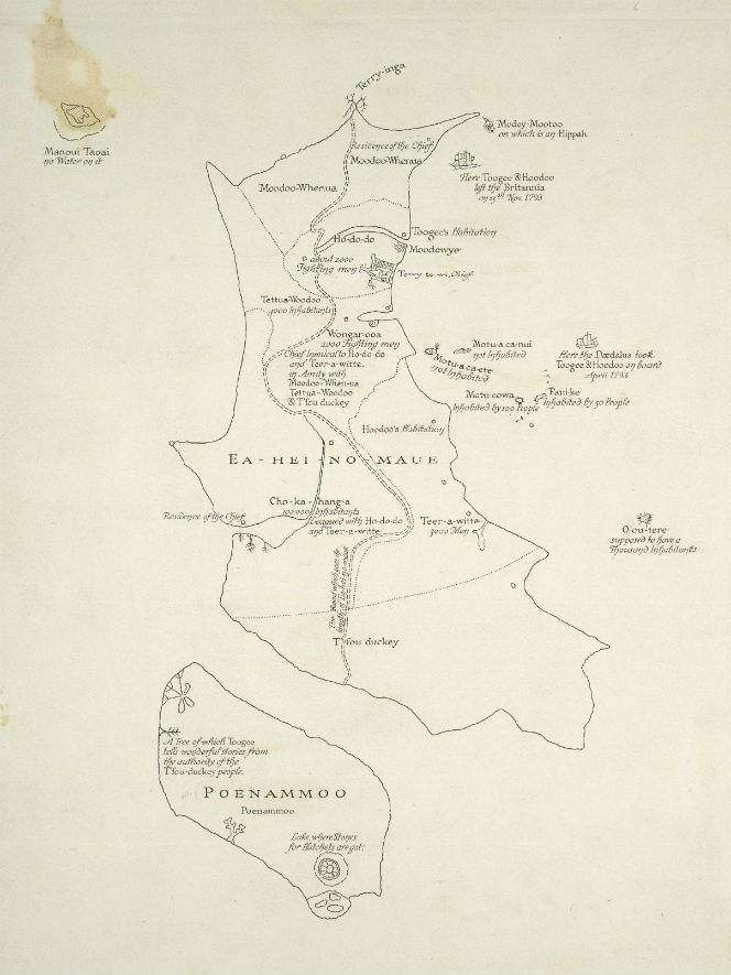
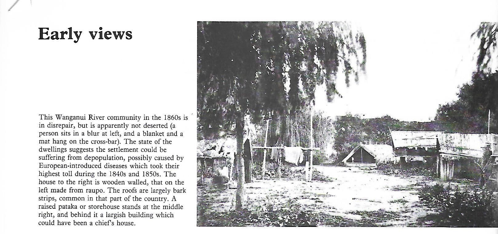

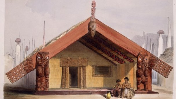
Photo from Maori: A Photographic and Social History. Revised Edition By Michael King, 1996
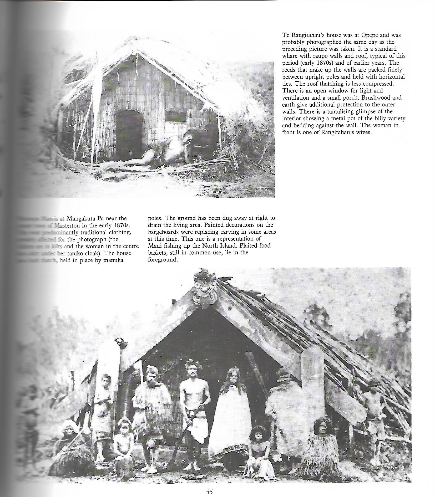
Photo from Maori: A Photographic and Social History. Revised Edition By Michael King, 1996
Photo from Maori: A Photographic and Social History. Revised Edition By Michael King, 1996
Photo from Maori: A Photographic and Social History. Revised Edition By Michael King, 1996
Photo from Maori: A Photographic and Social History. Revised Edition By Michael King, 1996

Photo from Maori: A Photographic and Social History. Revised Edition By Michael King, 1996
Photo from Maori: A Photographic and Social History. Revised Edition By Michael King, 1996
Photo from Maori: A Photographic and Social History. Revised Edition By Michael King, 1996
Photo from Maori: A Photographic and Social History. Revised Edition By Michael King, 1996
Photo from Maori: A Photographic and Social History. Revised Edition By Michael King, 1996

Photo from Maori: A Photographic and Social History. Revised Edition By Michael King, 1996

Photo from Maori: A Photographic and Social History. Revised Edition By Michael King, 1996


Leave a comment